
Wednesday, June 10—Myrtle Beach, SC to Kill Devil Hills, NC
I didn’t think I’d be writing this any time soon, but it was chilly this morning. The roads were cooled by last night’s rainfall, and the sky was overcast. I considered putting on a jacket, but enjoyed being cold, at least for a little while. By noon any concern about a chill became irrelevant as the humidity rose and the sun came out fiercely.
You might notice my routing was a little crazy today. I made many highway changes as I wound my way through the coastal area of South and then North Carolina. In North Carolina I cruised the Cape Fear Historic Byway, the Croatan national forest, and eventually the Pamlico Scenic Byway. The homes lining the byways varied greatly in terms of upkeep. Some were neat and tidy, others had debris, toys, and/or spare equipment and parts strewn all over the place. But they all had one thing in common…neatly cut lawns—huge lawns. I’ll bet I spotted 50 drive mowers, in some cases it appeared that a father and son were both cutting the vast lawns surrounding their homes, right into the drainage ditches that were filled with rain runoff.
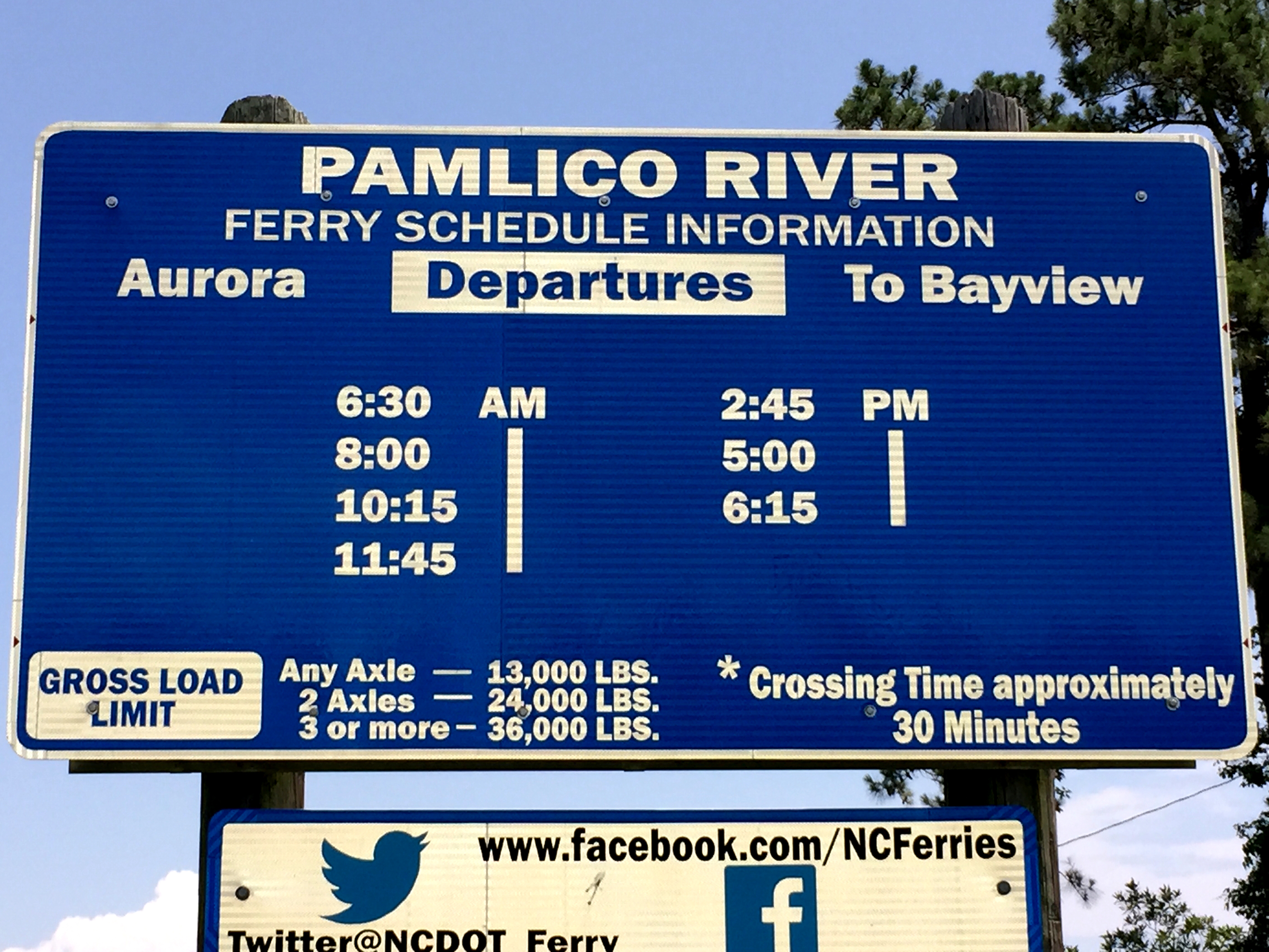
 I previously considered taking highway 12 north and the Cedar Island to Ocracoke and Ocracoke to Hatteras Ferries, but my previous experience with a ferry and 3.5 hours combine crossing time convinced me to plan around the ferries. I followed my GPS directions diligently as I noticed signs indicating distances to the Cedar Island and Aurora ferries. As I wound through the first routes in brackets below, I suddenly got a bad feeling in my gut. The GPS told me to turn left in a mile, and I looked out over the water for a bridge, but didn’t see one. Sure enough, somehow the GPS routed me to the Bayview-Aurora Ferry crossing Pamlico Sound. I resolved to go ahead and take the ferry as I pulled into a vacant parking lot where vehicles are queued to board. It was 12:45 pm and the last ferry left an hour ago. The next one wasn’t scheduled to leave until 2:45 pm. I thought about hanging out at the little park adjacent to the parking lot. It had a few picnic tables with canopies over them to provide shade. Then, maybe 30 seconds later I got on my Harley and headed west to Washington and the route around the sound, completing the extra, bracketed highway changes.
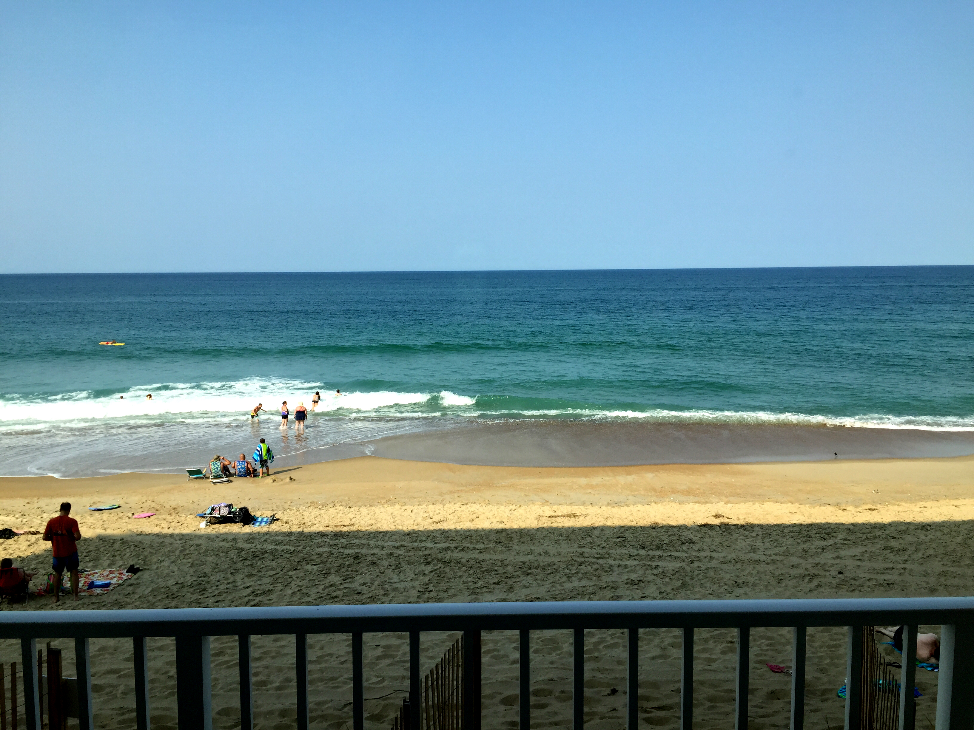
View from my room at Sea Ranch Resort
It rained for about five minutes as I approached the bridge that crosses the Croatan Sound to Roanoke Island, and then Roanoke Sound to the Cape Hatteras National Seashore. Roanoke Island and Nags Head are high-end locations here in the Outer Banks near Kill Devil Hills. The town is home to the site of the Wright brothers‘ first controlled, powered airplane flights on December 17, 1903, which were commemorated by the Kill Devil Hill Monument, which was dedicated in 1932.
I stayed in a beachfront hotel at the lower end of the spectrum. Still it was nice to sit in a cold room and take in the view of the beach outside my window.
Route: 17N, 22W, 31N, 17N, 74E, 421N, I140E, 17N, 24E, McCabe Rd N, 70N, 55E, 17N, [304E, 306N, 33E, 306N, 306S, 33W, 17N], 264E, 64E, 158N
Miles Today: 402
Time Today: 8:50
Total Trip Miles: 5,673
Weather: Overcast and cool in the low 70s turning to high 80s by mid-day
Lunch: Clif Bar
Lodging: Sea Ranch Resort
Dinner: Beach Side Bistro
